Papakura District (Papakura)
Papakura District was a local council territory in New Zealand's Auckland Region that was governed by the Papakura District Council from 1989 until 2010. The area makes up the southernmost part of the Auckland metropolitan area.
The area was originally a small independent city, until it became Papakura District in the 1989 reorganisation of New Zealand's local governments, and has now been overtaken by Auckland's urban sprawl. The district is flanked by beaches on the Manukau Harbour to the west, Manukau City to the north and east, and had Franklin District to the south.
In 2010, Papakura District boundaries covered 123 square kilometres and the centre of the district was located 32 km from downtown Auckland.
The geography of the district encompasses fertile plains, the inlets and foreshores of the Manukau Harbour, and the rolling foothills of the Hunua Range; a relatively narrow but strategically well positioned narrow span of land between the Hauraki Gulf and the Manukau Harbour. Much of the district – particularly in the west – is flat to rolling land. There is extensive peat soil in the Takanini area, which was once a vast wetland and peat bog. In the east, low-to-medium-sized foothills lead out into the Hunua range.
Keri Hill has pastoral lifestyle blocks overlooking Ardmore; Red Hill offered a strategic vantage point for the indigenous Maori people, but is now a popular suburb; Pahurehure has a harbourside setting on the eastern reaches of Manukau Harbour. Drury is the first genuine country town south of Auckland, and Takanini is Papakura's main industrial zone.
Map - Papakura District (Papakura)
Map
Country - New_Zealand
 |
 |
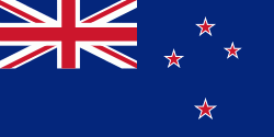
| Flag of New Zealand | |
The islands of New Zealand were the last large habitable land to be settled by humans. Between about 1280 and 1350, Polynesians began to settle in the islands and then developed a distinctive Māori culture. In 1642, the Dutch explorer Abel Tasman became the first European to sight and record New Zealand. In 1840, representatives of the United Kingdom and Māori chiefs signed the Treaty of Waitangi, which in its English version declared British sovereignty over the islands. In 1841, New Zealand became a colony within the British Empire. Subsequently, a series of conflicts between the colonial government and Māori tribes resulted in the alienation and confiscation of large amounts of Māori land. New Zealand became a dominion in 1907; it gained full statutory independence in 1947, retaining the monarch as head of state. Today, the majority of New Zealand's population of 5.1 million is of European descent; the indigenous Māori are the largest minority, followed by Asians and Pacific Islanders. Reflecting this, New Zealand's culture is mainly derived from Māori and early British settlers, with recent broadening of culture arising from increased immigration. The official languages are English, Māori, and New Zealand Sign Language, with the local dialect of English being dominant.
Currency / Language
| ISO | Currency | Symbol | Significant figures |
|---|---|---|---|
| NZD | New Zealand dollar | $ | 2 |
| ISO | Language |
|---|---|
| EN | English language |


